Most product managers think of field data as a capture problem. But it's also an interpretation problem, and that changes everything about how you build for it. In telecom and utilities, there's a significant gap between raw field imagery and the structured data required for engineering decisions. The hard part isn't just capturing images of utility poles. It's also converting those images into the 50+ attributed data points required by engineering and permitting workflows—at scale.
Why It's Harder Than It Looks
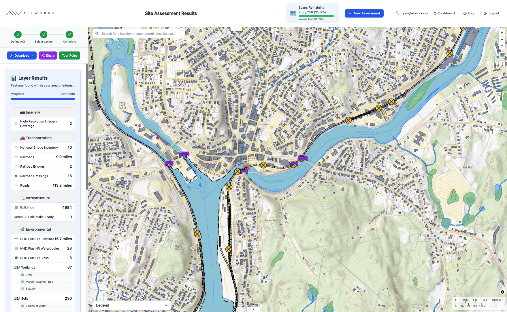
When a fiber designer asks "Can I attach to this pole?", a photograph can't accurately answer that. It requires structured data: pole height, class, material, loading capacity, attachment heights measured to the inch, clearances between power and communication space, ownership, regulatory context, vegetation encroachment—and more.
When a fiber designer asks “Can I go underground in this area,” modern LiDAR and aerial imagery can capture extensive right-of-way in hours. The bottleneck is interpretation: converting raw data into the precise measurements and attributes engineering software requires. That interpretation traditionally depends on scarce experts—and their expertise doesn't scale.
Generic AI can't solve this either. A utility pole might have a dozen attachment types, each with distinct spatial requirements and ownership implications. Identifying them requires contextual reasoning: that black cable at 24 feet is probably fiber if there's a splice enclosure nearby, but might be coax if there's an amplifier in the span. Computer vision alone can't make those calls.
Principles for Physical Infrastructure Products
This work has reinforced a few core lessons for product managers (PMs):
The data model defines the product. Getting the ontology right—entities, attributes, relationships—matters more than any feature. A flawed data model can't be fixed downstream.
Accuracy before speed. Consumer software can iterate fast. Infrastructure can't. Measurement errors mean failed permits or safety violations.
Integration is everything. Field intelligence only creates value when it flows into CAD, GIS, permit systems, and asset databases. Your product's value depends on delivering data where decisions get made.
Domain specificity beats general-purpose AI. Generic computer vision can identify a pole. Extracting actionable data requires deep encoding of NESC codes, utility practices, and make-ready engineering.
The opportunity is significant. Future infrastructure—fiber, grid modernization, EV charging—depends on understanding current right-of way conditions. Products that deliver this accurately and at scale will be foundational.
Questions about AirWorks' approach? Reach out to our team.

.png)
.png)